
The Municipality of Agia launches a series of proposals for the summer of 2025. With its 45 km coastline, its endless destinations, the beauties of Kissavos and Mavrovounio, and its vast cultural heritage, the Municipality of Agia proposes 45 “steps” for this summer’s visitors, for 45 days from July 1 to August 15.
Each destination, each kilometre for each day, becomes a “travel guide” for visitors who have the intention to discover or remember the beauties of the Municipality of Agia.
Every day, a new destination or an activity filling the summer of the visitors of the region with unique experiences and suggestions for relaxation, tastes and recreation.
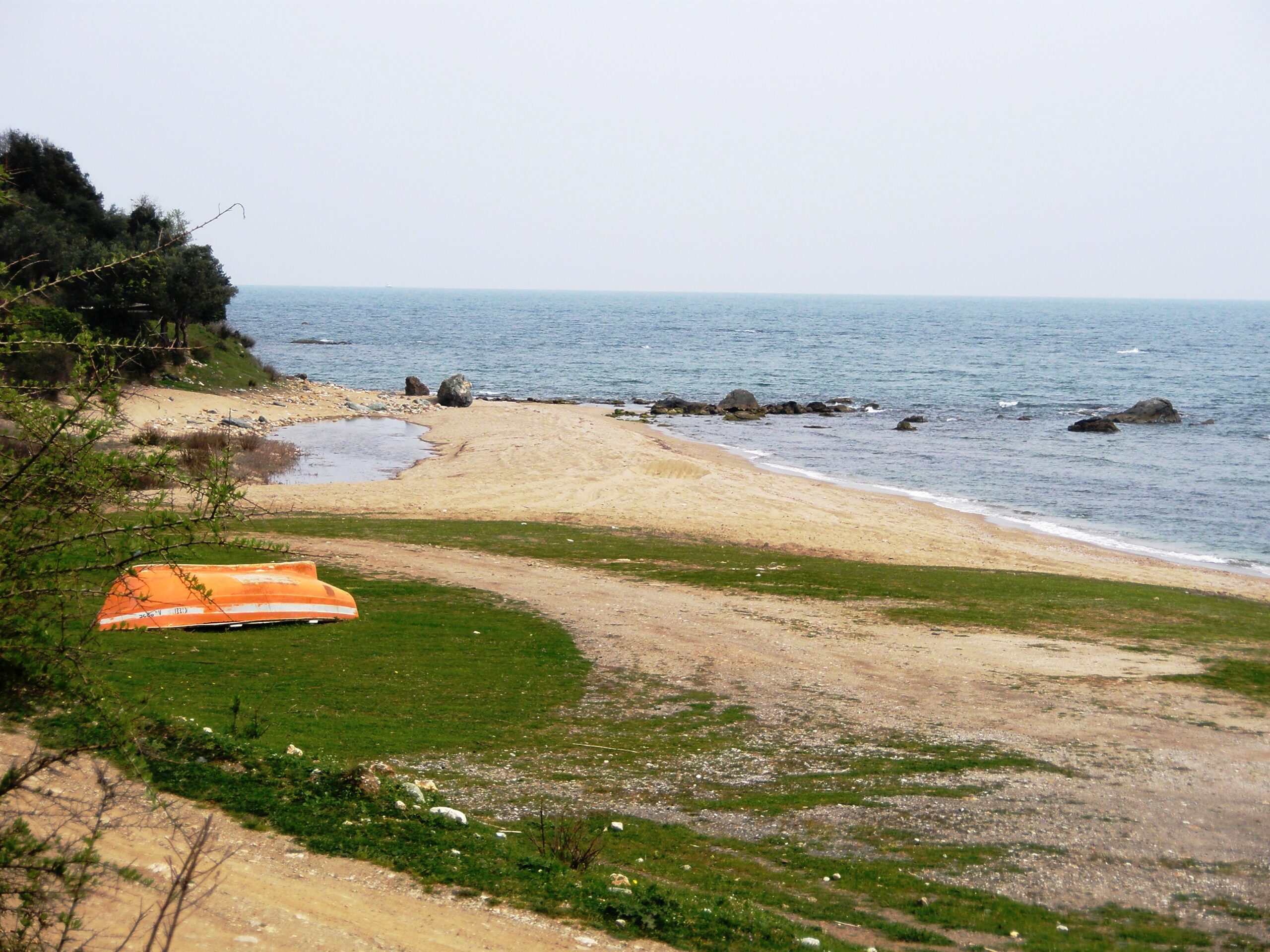
Asprovrachos Beach
Step#1 Asprovrachos Beach
The southernmost coast of the municipality, which is the boundary of the Regional Unit of Larissa with Magnesia The name of the municipality is “imprinted” in the white rock that faces whoever explorer manages to reach the coast from a difficult but beautiful route It has two coasts with a strong rocky coastline with very clear waters but… a little frozen. The coast has a self-sustaining fresh water that can be found by simply digging next to the wave!
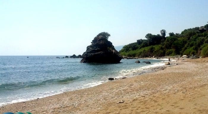
Step#2 Mylos- Glymeni
The second southernmost beach of the Municipality of Agia. Characteristic of the beach is the large rock of Monopetro that is located in the sea, but also the mines that create an eerie image and hide myths and stories from the past. It is the location where it is said that “The naval battle of Salamis was won here”. Legend has it that Xerxes anchored all the ships at this spot. In the evening he “caught” an easterly weather and lost half of his fleet….He came down to Salamis weakened, so the development was easier over. of Greece.
The mines whose operation comes up to 1950 produced the so-called “talc”.
On the seabed is from another era, a wooden German ship that carriedgold At a depth (2-3m) several times depending on the currents, it is visible even from the sea surface. Shore with large pebbles not suitable for relaxed swimming but ideal for snorkeling and bottom watching.
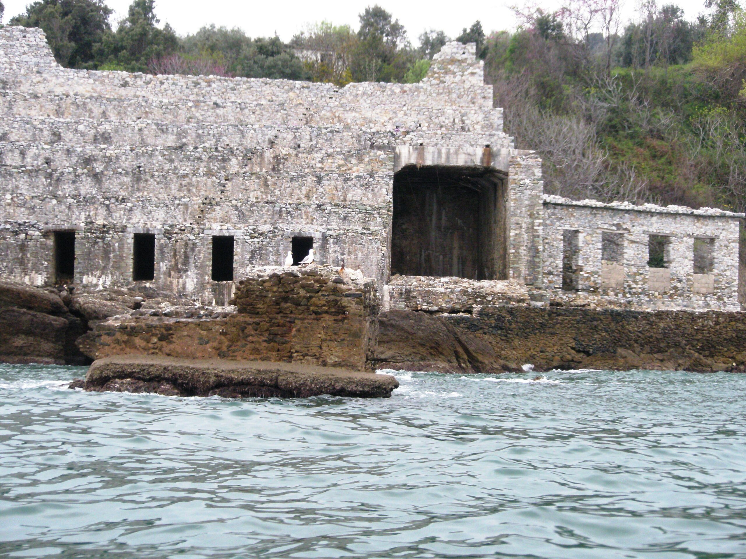
Mylos- Glimmeni, Beach
Step#3 Sklithro – Path to the sea
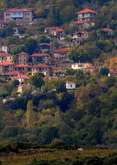
A village literally immersed in lush greenery, on the foothills of Mavrovouni, in a location that ideally combines mountain and sea, nestled among centuries-old oaks. It is situated to the south of Agiokampos and oversees the area from Rakopotamos to the borders of Keramidi.
It was founded in a fortified position during the Ottoman period to avoid pirate raids. According to local tradition, the village got its name from a centuries-old alder tree that once stood there.
The Path to the Sea
The trail begins from the settlement of Sklithro and, passing through the area of Isiomata, ends at the location Metallio on the Mylos Glymeni coast, with a total length of 5 km, extending through the Sklithro community forest. Along the path, rest and recreation facilities (picnic tables, kiosks, benches, stone fountains) have been created at the spots “Agioi Taxiarches” and “Profitis Ilias,” so that hiking visitors can enjoy the flora of Kissavos during their walk
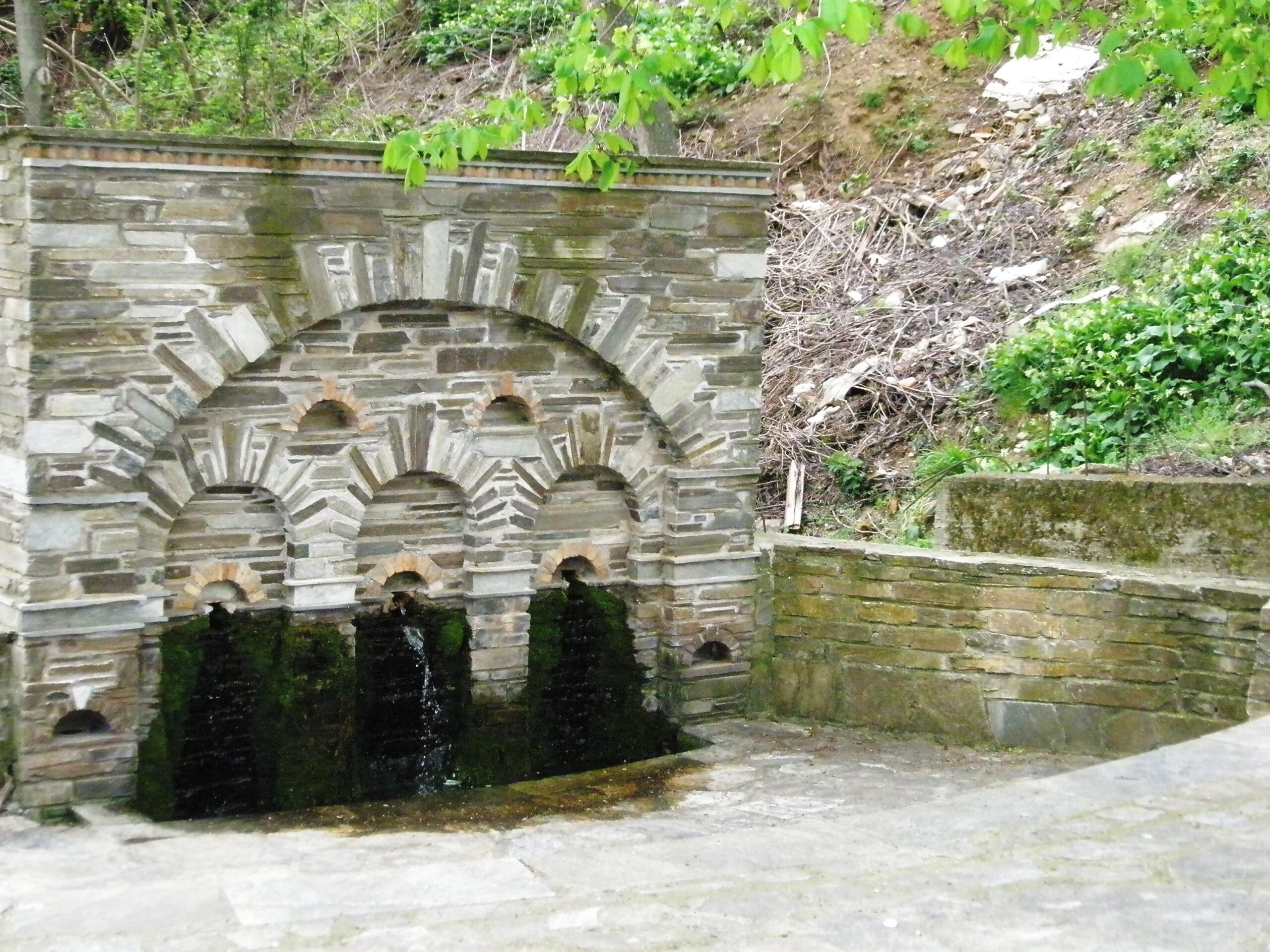
Sklithro
Step#4 Beach of colors
Next to Metallio or Mylos Glymeni, it is easy to understand where the name comes from. The shades one can see are found on the vertical rocky “canvas” dominating the center of the coast. Green, red, white, yellow, and black sand sticks to our bodies while sunbathing. The beach is also where the hiking route from Sklithro to Mylos Glymeni ends. There is a small sandy shore outside with many stones in the sea. The sun sets early!
There is a lake located right next to the beach.
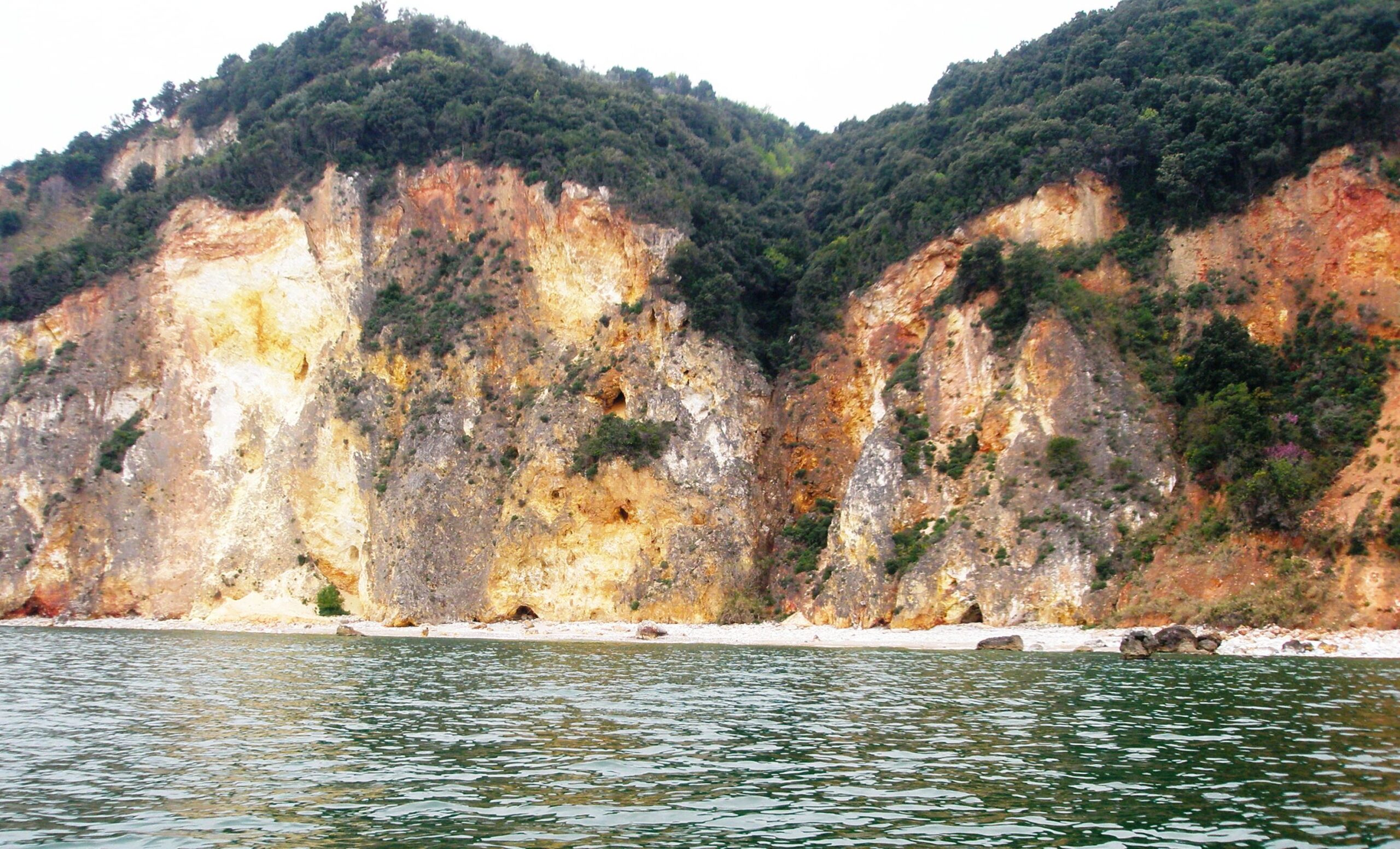
Beach of Colors
Steo#5 2025 Rakopotamos
One of the most beautiful coasts of the region.
It has three beaches in its development. Two of them are separated by a “serving” rock, the greenery really touches the sea while the shadows play with the light, throughout the day in the turquoise waters. The exotic image of the coast is complemented by the golden fine sand.
Rakopotamos
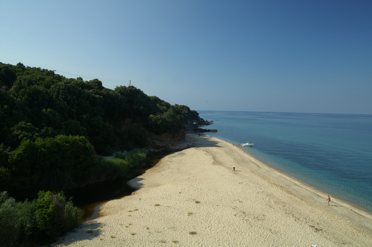
6 July 2025 Papakosta Beach
Papakosta Beach is a beautiful and tranquil beach with a sandy stretch of about one kilometer located in Lower Polydendri.
It formerly belonged to the estate of the former royal property, which is why it has retained the nickname “royal.” It is surrounded by a forest of strawberry trees and kermes oaks that provide natural shade. The clusters of rocks, the reflections on the blue water, and the sandy shore create an “earthly paradise.”
For those who can swim and want to explore a unique underwater world with a mask, it is worth swimming 200 meters out. You will be rewarded with a rocky islet right in front of the beach that hides many species of fish with unique colors.
Papakosta Beach
July 7 Polydendri Beach
A small but special beach in Polydendri. 400m of sand and pebbles divided in two. Small beaches can be discovered and others inside the settlement by paths. Just above is the large forest of Polydendri and former royal estate with many walking options with very good signage.
Polydendri Beach


Leave A Comment