
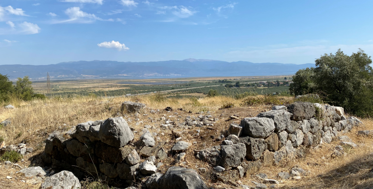
The Ministry of Culture, through the competent Ephorate of Antiquities of Fthiotida, with the stabilization and restoration of the Phocian Wall, one of the most significant monuments in the historical landscape of Thermopylae, as it was there that the final phase of the battle between the Greeks and the Persians took place.
The wall is currently in fair to poor condition, as its long-term exposure to the elements and seismic stresses have caused significant damage. The project is part of a broader plan to unify, protect, and highlight the monuments and sites of archaeological interest at Thermopylae, with the aim of fostering a better understanding of the area’s topography and enhancing the visitor experience.
According to the approved plans, the stonework will be realigned and restored using the available original building material, which will be repositioned in its original locations or in new, documented locations. The plan also calls for the reinstallation of scattered stones and the restoration of the structure’s geometry. The planned interventions aim to protect the authentic remains, ensure the monument’s stability, and restore the legibility of its form and architectural organization.
The designated archaeological site of Thermopylae includes the three passes mentioned by Herodotus in his account of the battle of 480 B.C. between the Greeks and the Persians (the Western, Middle, and Eastern Passes). In the Middle Pass, where the hot springs from which the area takes its name are located, stands the site’s most significant fortification, the so-called Phocian Wall, which Herodotus refers to as the “Phocian wall.” The wall is situated southwest of Kolonos Hill and is a fortification built in the 6th century B.C. by the Phocians to repel the raids of the Thessalians during the Sacred Wars. When, in 480 B.C., the Greek city-states decided to confront the Persian invasion, this ancient wall was hastily repaired and used by the Spartans and their allies as a key bastion in the defense of Thermopylae. Behind it, the Spartan camp had been set up. The final phase of the battle took place in the area of Kolonos Hill in 480 B.C. The landscape of the area has changed radically from antiquity to the present day. In antiquity, the land passage of Thermopylae—which served as the main route between southern Greece and Thessaly—ran, as Herodotus notes, through three successive narrows stretching 9 km between the region’s steep ridges, since the sea once covered almost the entire area where the plain lies today.
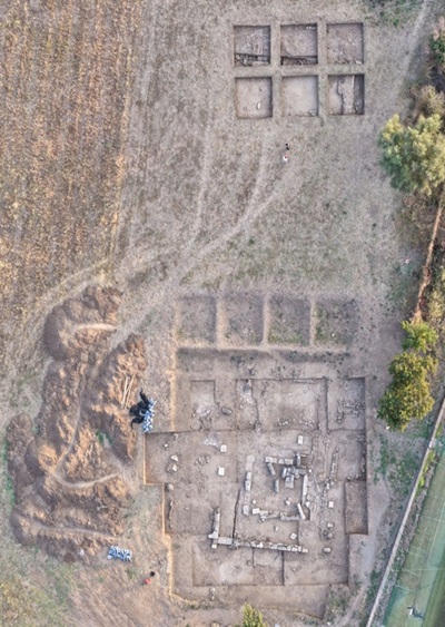
Systematic archaeological research in the area was organized in 1939 by Spyridon Marinatos. The discovery on Kolonos Hill of a large number of iron and bronze spears and arrowheads dating to the 5th century B.C., many of which are of Eastern types, contributed decisively to documenting the historical topography of the area and identifying it as the battlefield of Thermopylae. The Phocian wall is elongated, approximately 100 meters long, with a sharply zigzagging plan, adapted to the topography of the hilltop. The remains of the wall and the tower that survive today are preserved mainly at a low elevation. As part of the first phase of the project, an archaeological survey was conducted and extensive vegetation clearance was carried out, revealing the actual outline of the fortification and improving access to and visibility of the monument. Archaeological trenches dug along the wall and the western tower investigated the foundation and the structure’s construction, while extensive concentrations of fallen stones were uncovered; these were sorted and documented in preparation for restoration work. Inside the western tower, interior masonry, pithoi, and layers of ash were identified, indicating complex and successive uses. At the same time, a significant amount of movable material was collected, including a bronze coin from the Hellenistic period (323–319 B.C.), which contributes to the investigation of the fortification’s chronology and later use.


Leave A Comment